
Geomatics Drone Simulator Supplier Guide to Realistic Geospatial Training
2026-09-19
When it comes to geomatics drone training, realism isn't just a nice-to-have—it's the difference between a skilled operator and a costly mistake. Most simulator guides stop at listing features, but this one focuses on what actually prepares teams for real-world spatial data capture. You'll see how a supplier like SRIZFLY approaches terrain fidelity, sensor physics, and mission variability in ways that generic tools simply can't match. If your goal is to move beyond checkbox training and into genuine geospatial readiness, read on.
Payload Emulation That Mirrors Field Geomatics Workflows
Emulating payloads for geomatics work isn't about tossing a few sample datasets at a simulator and hoping for the best. The goal is to reproduce the entire field-to-finish chain with enough fidelity that a surveyor or GIS technician forgets they aren't holding a real GNSS receiver or total station. That means the emulation has to handle the messy parts: signal dropouts under tree canopy, base station radio latency, tilt compensation quirks, and the occasional blunder where a rod height gets entered wrong. Mirroring these workflows demands more than raw coordinate playback—it requires simulating how the instrument itself behaves, from warm-up times to battery drain to the way a data collector logs raw observations versus corrected positions.
A well-built payload emulator interleaves hardware states with software reactions. For instance, when a virtual RTK rover loses fix near a building, the emulated payload shouldn't just blank out—it should degrade to float, then to autonomous, all while the controller screen shows the same confidence indicators a crew would see. Similarly, a robotic total station emulation needs to respect search routines, lock-loss triggers, and prism constant mismatches. The trick is to model the workflow as a sequence of field decisions rather than a linear stream of coordinates. You simulate an operator setting up a base over an unknown point, performing a site calibration, or running a topo loop with coded features. Each action feeds the next, so the payload behaves like an instrument reacting to its environment, not a pre-scripted animation.
The payoff shows up when training new hires or stress-testing office software. Instead of risking expensive gear or waiting for decent weather, a crew can rehearse a control network layout on a laptop, complete with radio interference and an uncooperative prism pole. Data processors get realistic raw files with multipath noise, cycle slips, and timestamp gaps that mirror what actually comes back from the field. Nobody has to fake a bad day—the emulator does it naturally, because it was built around the same workflow bottlenecks that make real geomatics projects unpredictable. That's the difference between a payload simulator that just pushes numbers and one that genuinely mirrors how field work unfolds.
Terrain Models Built for Measurement, Not Just Scenery
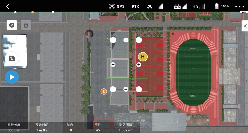
Some terrain replicas exist to impress with dramatic ridgelines and miniature forests. The ones that earn a place in a surveyor's toolkit are different. Every rise and dip corresponds to a measured point, not an artistic guess. Contours are traced from LiDAR scans or total station records, and vertical exaggeration is applied only when it serves a clear analytical purpose. The goal isn't to look like a landscape painting; it's to let an engineer read slope percentages, drainage paths, and cut-and-fill volumes directly from the surface.
Builders of these models treat the ground as a dataset first. Plywood layers follow exact elevation intervals, CNC routers cut foam from digital elevation models, and 3D printers lay down resin at sub-millimeter scales. Someone who needs to plan a retaining wall or model flood spread can place a scale ruler against a ridge and get a number that matches the field notes. Scenery gets in the way; clean edges and tight tolerances don't. That's why many working models skip the paint, the fake grass, and the tiny trees.
Training Beyond Visual Line of Sight Without the Risk
Learning to operate an aircraft beyond visual line of sight traditionally meant sending a pilot and an expensive machine into the unknown, where a single miscalculation could end in disaster. Modern training programs have flipped that equation entirely. By pairing high-fidelity simulators with real-time telemetry overlays, trainees can practice long-range navigation, signal loss recovery, and emergency decision-making from the safety of a ground station. The result is a skill set built through repetition and controlled failure, not through white-knuckle moments in live airspace.
What makes this approach stick is the ability to compress months of real-world exposure into days of focused scenario work. An instructor can inject a sudden weather front, a shifting regulatory boundary, or a degraded propulsion system at any point, forcing the student to react without ever leaving the chair. Because the consequences are simulated but the data streams are real, operators develop an intuitive feel for latency, bandwidth limits, and sensor degradation that no textbook can teach. They learn to trust their instruments and their training, not their line of sight.
Companies and flight schools are now using these risk-free environments to certify pilots for missions that were once considered too dangerous to practice. From pipeline inspection to offshore delivery, the gap between simulation and actual operation has narrowed to the point where a trainee's first real beyond-visual-line-of-sight flight feels like a familiar routine rather than a leap of faith. That confidence, built without burning fuel or risking a hull, is what turns a theoretical capability into an everyday operational skill.
Stress-Testing Flight Plans With Weather and Signal Loss
Every flight plan looks solid on a clear day, but the real test comes when the weather turns hostile and the radio goes quiet. Pilots and dispatchers need to run scenarios that push the plan to its breaking point, not just skim through the usual checklists. For instance, a sudden line of thunderstorms over the planned route can force a diversion with less fuel margin than expected, while a simultaneous loss of satellite navigation signals leaves the crew relying on older, less precise instruments. These stacked failures don't happen often, but when they do, the difference between a safe landing and a serious incident often comes down to how thoroughly the plan was stress-tested beforehand.
One practical approach is to build a tabletop exercise that combines two or three independent disruptions, such as a tropical storm developing faster than forecast, a temporary failure of the aircraft's communication system, and an unexpected altimeter setting error at the destination. By walking through each minute of the flight with these conditions layered on top, flight planners can spot gaps that a single-disruption test would miss. For example, losing both VHF voice and datalink while trying to re-route around weather means the crew cannot easily receive updated clearances, so the plan must include pre-agreed contingency routes and altitude blocks. Without that kind of rehearsal, a plan that looks robust on paper may crumble when the first real problem appears.
Stress-testing also means questioning the assumptions hidden inside performance charts and weather briefings. A headwind that was supposed to stay at 40 knots might shift to a 70-knot crosswind at the alternate airport, cutting into the reserve fuel that was barely adequate on paper. Add a partial loss of GPS and a missed approach at an unfamiliar field, and the workload climbs fast. Planners who treat these tests as routine, rather than as a box to tick, tend to build in more realistic buffers and clearer decision points for the crew. The goal is not to predict every possible failure, but to make the plan flexible enough to survive the ones that actually happen.
Integrating Simulator Outputs Into Your Geospatial Stack
Bringing simulator data into a real geospatial workflow rarely works out of the box. The coordinate systems drift, elevation models disagree, and the nice clean 3D tiles you previewed suddenly refuse to align with your basemap. A practical approach is to treat simulator output as just another sensor feed: normalize timestamps, project every vertex into a shared CRS, and store the result as GeoJSON or 3D Tiles with explicit metadata. Once you stop treating the simulation as a separate world, it becomes possible to query paths, overlay environmental layers, and even trigger alerts when a simulated asset crosses a real boundary.
The real value shows up when you stop exporting screenshots and instead stream live simulation state into a spatial index. Use a lightweight message queue to push entity positions, then let your geospatial stack handle the heavy lifting — spatial joins, dynamic styling, and time‑slider playback. This turns static simulation runs into something you can interrogate: which sensors were covered by smoke at 14:32, where did the drone corridor overlap a no‑fly zone, or how quickly did a flood inundation layer spread across a neighborhood. The key is keeping the geometry small and the attributes rich.
For teams that already maintain a GIS or digital twin, a thin adapter layer saves months of rework. Rather than rewriting the simulator to speak PostGIS or WFS, write a small sidecar process that watches the simulation’s log files, transforms each frame’s entities into OGC‑friendly features, and upserts them into a spatial table every few seconds. From there, your existing tooling — web maps, dashboards, analysis notebooks — picks it up without learning a new domain. The simulator stays focused on physics; your geospatial stack stays focused on location.
What to Ask a Simulator Supplier Before You Commit
Brochure accuracy numbers rarely tell you whether a simulator will actually behave like your equipment on a Tuesday afternoon. Ask for a validation report tied to a project similar in scale and fluid properties to yours. Then get the names of two engineers who ran that model—not the sales lead—and ask them what broke, what they had to tune, and how long it took. If the supplier hesitates on the failure cases, you’re not buying a simulator; you’re renting a demo.
Dig into the backend before signing. What thermodynamic package sits under the hood, and how often is it updated? Can you export the underlying equations, or are you locked into a black box? Request a trial with one of your own historical cases, not a canned example, and watch how the support team handles parameter fitting. If you can’t talk to the person who would actually fix your tickets during commissioning, that’s a red flag.
Finally, price the lifecycle, not the license. Ask about upgrade costs, concurrent user fees, and what happens to your custom models if you cancel. A good supplier will offer a clear path to export your work. If the answer to “can I take my models with me?” is vague, keep looking.
FAQ
Look for a supplier that lets you import actual project areas instead of limiting you to generic demo terrain. The simulator should reproduce sensor behavior under different light and atmospheric conditions, and the supplier ought to provide regular updates based on real aircraft firmware, not just cosmetic changes.
Pretty graphics can hide shallow physics. If the elevation model, surface reflectance, and obstacle data are not accurate, trainees learn habits that fail in the field. A good simulator builds its scenes from LiDAR or photogrammetry outputs so that mission planning feels like a real survey job.
At minimum you need a camera model with realistic exposure, a LiDAR scanner with beam divergence and point spacing, and a multispectral sensor with band response curves. Generic point clouds and colored rectangles do not teach someone how to interpret ground returns or calibrate exposure for mapping.
Not completely, but it can compress the learning curve. Emergencies, changing wind, battery failures, and airspace conflicts can be rehearsed repeatedly without risk. The key is that simulated flights must be logged with the same mission planning and data processing workflow as real operations.
Ask for a scenario with a sudden gust, low cloud ceiling, or changing sun angle. If the simulator only darkens the sky and adds rain particles, it lacks the physical effect on aircraft stability and sensor exposure. Useful weather simulation changes flight dynamics and image quality, forcing the trainee to adapt the mission.
It should connect to the same flight controller or ground control station used in the field. At the very least, it needs a stick controller and a way to import real geofence and flight plan files. Simulators that require trainees to learn a separate interface create a disconnect from actual operations.
Serious vendors release terrain updates, add new sensor models, and fix physics bugs based on feedback from licensed surveyors. They also offer validation against real flight data. If the supplier treats the simulator like a static software product, you will outgrow it quickly.
Conclusion
Choosing a geomatics drone simulator means looking past flashy graphics and asking whether the payload emulation actually mirrors what field crews do every day. A useful platform lets you configure the sensor weight, gimbal behaviour, and data capture intervals for LiDAR or multispectral rigs, so that flight time, battery drain, and coverage patterns match real hardware instead of generic camera defaults. Terrain models deserve the same scrutiny: they need to be built from surveyed control points and real elevation data so that slope, vegetation interference, and ground sampling distance can be measured rather than just admired. When the digital twin behaves like a survey-grade site, line-of-sight drills give way to safe beyond-visual-line-of-sight exercises, where trainees practice corridor mapping or stockpile volumetrics without putting aircraft, people, or permits at risk.
A strong simulator also earns its place by letting you stress-test flight plans under conditions that would ground a real crew. Push the mission through sudden gusts, rain cells, magnetic interference, or a full GNSS dropout and watch how the autopilot and return-to-home logic respond; that reveals weak waypoints and unrealistic turnaround expectations before they show up in the field. Beyond the flight itself, check how the tool exports georeferenced trajectories, image footprints, and point-cloud previews into your existing GIS or photogrammetry pipeline. If the output cannot drop cleanly into software like QGIS or Metashape without re-projection headaches, the training value shrinks. Before committing to a supplier, ask for a measured accuracy comparison against a real flight on the same site, a demo of the failure injection menu, and clear documentation of how sensor models are validated. Those details separate a genuine geomatics training partner from a generic drone game.
Contact Us
Contact Person: Niles Liu
Email: [email protected]
Tel/WhatsApp: 8619945009803
Website: https://srizfly.com/